Mean State
Download Data |
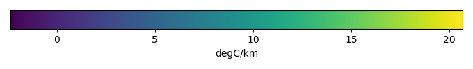
Period Mean (original grids) [degC/km] |
Model Period Mean (intersection) [degC/km] |
Benchmark Period Mean (intersection) [degC/km] |
Model Period Mean (complement) [degC/km] |
Benchmark Period Mean (complement) [degC/km] |
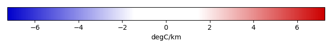
Bias [degC/km] |
Bias Score [1] |
Spatial Distribution Score [1] |
Overall Score [1] |
|||
|---|---|---|---|---|---|---|---|---|---|---|---|---|
| Benchmark | [-] | 9.77 | ||||||||||
| CanESM2 | [-] | 10.3 | 10.3 | 9.82 | 10.7 | 7.52 | 0.501 | 0.730 | 0.978 | 0.854 | ||
| CanESM5 | [-] | 9.70 | 9.70 | 9.79 | 9.96 | 7.40 | -0.0957 | 0.758 | 0.980 | 0.869 | ||
| CESM1-BGC | [-] | 9.89 | 9.89 | 9.78 | 9.93 | 8.41 | 0.106 | 0.762 | 0.982 | 0.872 | ||
| CESM2 | [-] | 10.4 | 10.4 | 9.78 | 10.8 | 8.11 | 0.604 | 0.755 | 0.985 | 0.870 | ||
| CNRM-CM5 | [-] | 10.7 | 10.7 | 9.79 | 10.8 | 7.54 | 0.904 | 0.725 | 0.980 | 0.853 | ||
| CNRM-ESM2 | [-] | 9.50 | 9.50 | 9.80 | 9.79 | 7.73 | -0.301 | 0.768 | 0.979 | 0.874 | ||
| GFDL-CM4 | [-] | 8.49 | 8.52 | 9.77 | 7.81 | -2.73 | -1.25 | 0.771 | 0.988 | 0.879 | ||
| GFDL-ESM2G | [-] | 9.72 | 9.72 | 9.86 | 10.1 | 4.23 | -0.160 | 0.719 | 0.978 | 0.848 | ||
| GFDL-ESM2M | [-] | 9.53 | 9.52 | 9.86 | 9.71 | 3.42 | -0.296 | 0.718 | 0.971 | 0.844 | ||
| GFDL-ESM4 | [-] | 9.65 | 9.67 | 9.77 | 9.13 | 0.350 | -0.0966 | 0.753 | 0.982 | 0.868 | ||
| HadGEM2-ES | [-] | 9.03 | 9.01 | 9.80 | 9.69 | 7.47 | -0.797 | 0.684 | 0.918 | 0.801 | ||
| IPSL-CM5A-LR | [-] | 10.2 | 10.2 | 9.80 | 10.6 | 7.64 | 0.399 | 0.714 | 0.975 | 0.844 | ||
| IPSL-CM5A-MR | [-] | 9.71 | 9.69 | 9.80 | 10.1 | 7.64 | -0.102 | 0.721 | 0.976 | 0.848 | ||
| IPSL-CM6A-LR | [-] | 10.9 | 10.9 | 9.80 | 11.3 | 7.50 | 1.12 | 0.705 | 0.973 | 0.839 | ||
| meanCMIP5 | [-] | 9.83 | 9.84 | 9.77 | 9.68 | 8.43 | 0.0645 | 0.770 | 0.988 | 0.879 | ||
| meanCMIP6 | [-] | 9.77 | 9.81 | 9.77 | 8.99 | 0.0346 | 0.792 | 0.990 | 0.891 | |||
| MPI-ESM-LR | [-] | 10.2 | 10.2 | 9.79 | 12.2 | 7.29 | 0.401 | 0.720 | 0.975 | 0.847 | ||
| MPI-ESM-MR | [-] | 9.44 | 9.43 | 9.78 | 10.7 | 9.47 | -0.348 | 0.754 | 0.980 | 0.867 | ||
| MPI-ESM1-2-HR | [-] | 9.49 | 9.48 | 9.78 | 10.5 | 9.47 | -0.296 | 0.752 | 0.965 | 0.858 | ||
| NorESM1-ME | [-] | 9.01 | 9.01 | 9.78 | 9.03 | 8.36 | -0.771 | 0.677 | 0.948 | 0.812 | ||
| NorESM2-LM | [-] | 10.3 | 10.3 | 9.78 | 10.3 | 8.60 | 0.502 | 0.685 | 0.950 | 0.817 | ||
| UKESM | [-] | 9.23 | 9.23 | 9.79 | 9.58 | 7.67 | -0.569 | 0.769 | 0.980 | 0.874 |
Temporally integrated period mean