Download Data |
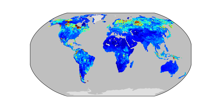
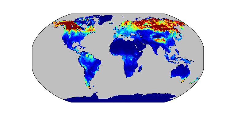
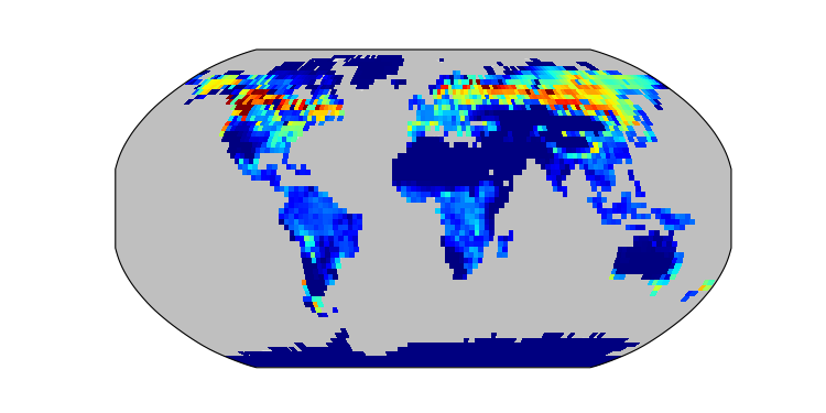
Period Mean (original grids) [Pg] |
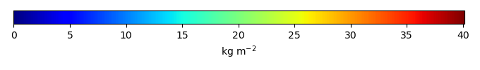
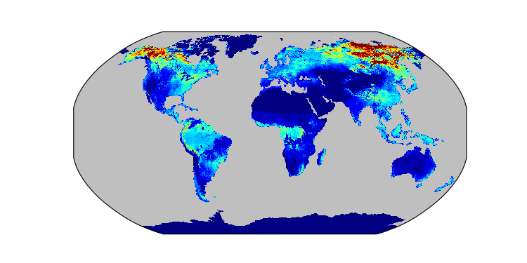
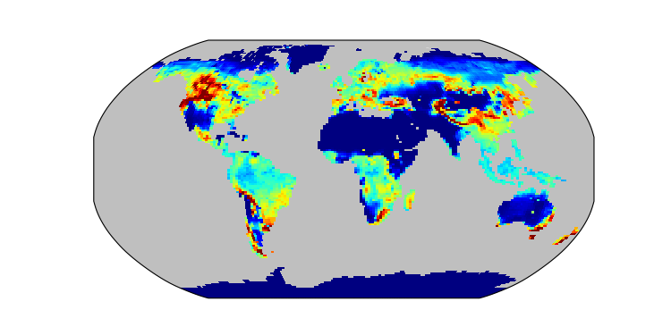
Model Period Mean (intersection) [Pg] |
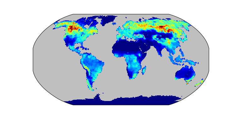
Benchmark Period Mean (intersection) [Pg] |
Model Period Mean (complement) [Pg] |
Benchmark Period Mean (complement) [Pg] |
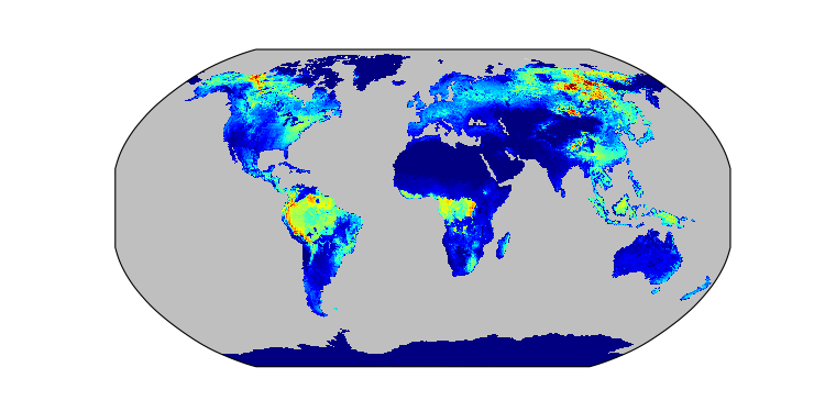
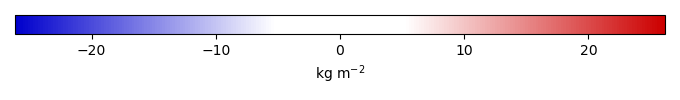
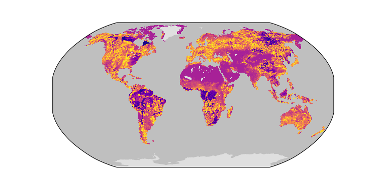
Bias [kg m-2] |
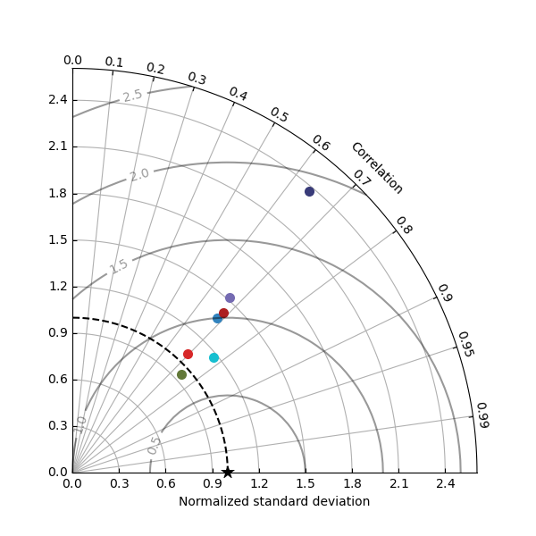
Bias Score [1] |
Spatial Distribution Score [1] |
Overall Score [1] |
|||
|---|---|---|---|---|---|---|---|---|---|---|---|---|
| Benchmark | [-] | 1.33e+03 | ||||||||||
| BCC-CSM2-MR | [-] | 1.54e+03 | 1.52e+03 | 1.31e+03 | 16.7 | 20.9 | 1.90 | 0.529 | 0.422 | 0.476 | ||
| BGCv2LND.GSW | [-] | 1.20e+03 | 1.20e+03 | 1.31e+03 | 1.36 | 21.7 | -0.812 | 0.596 | 0.747 | 0.671 | ||
| BGCv2LNDATM | [-] | 1.14e+03 | 1.14e+03 | 1.31e+03 | 1.33 | 21.7 | -1.26 | 0.576 | 0.844 | 0.710 | ||
| CanESM5 | [-] | 1.34e+03 | 1.29e+03 | 1.33e+03 | 32.8 | 1.00 | 0.616 | 0.868 | 0.742 | |||
| MeanCMIP6 | [-] | 1.43e+03 | 1.41e+03 | 1.33e+03 | 23.2 | 1.39 | 0.610 | 0.864 | 0.737 | |||
| MIROC-ES2L | [-] | 1.11e+03 | 1.07e+03 | 1.33e+03 | 30.3 | 3.30 | -1.25 | 0.562 | 0.766 | 0.664 | ||
| UKESM1-0-LL | [-] | 1.75e+03 | 1.72e+03 | 1.31e+03 | 25.6 | 23.0 | 4.23 | 0.493 | 0.704 | 0.598 |
Temporally integrated period mean click to collapse contents